Back to listing
The Island Loop Route, National Water Trail
Expand All
Description
**2024 UPDATE** The Tainter gate where the canal meets with Lake Huron is broken in the down position as of May 2024. The City of Port Huron is working to get this repaired.
The Island Loop Route
National Water Trail - State Water Trail
Have your ID with you as the waters are patrolled by Border Patrol Agents.
The Island Loop Route was designated as Michigan’s first National Water Trail in November 2013. The mission of the Island Loop Route is to provide a safe, unique and exciting recreational experience for residents and visitors of all abilities to enjoy as they navigate four distinct water bodies in St. Clair County.
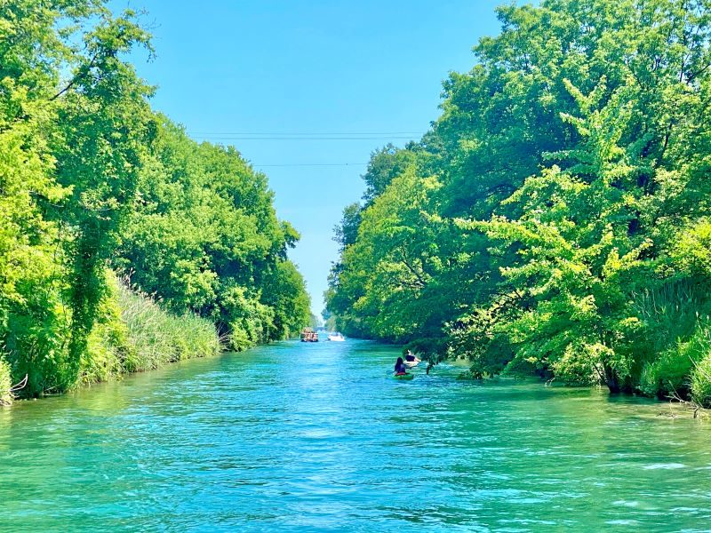
Paddlers put in at North River Road Park on the Black River. Then head east through a separate canal and under the Tainter Gate before entering Lake Huron just north of Lakeside Park. From there, paddlers head south under the Blue Water Bridge and into the St. Clair River before heading back north at the mouth of the Black River through downtown Port Huron.
Advanced: International Shipping Traffic and Currents
Start at Bakersfield Park in the Black River. Head up the canal (1 mile) and through the Tainter gate into Lake Huron. Head south, towards Lakeside Beach, going under the Blue Water Bridge into the St. Clair River. Life jackets, ID (international border) and experience paddling recommended. There is shipping traffic and rapids in the St. Clair River from Lighthouse Beach until you reach the Black River entrance in Downtown Port Huron. The kayak launch at Bakersfield is ADA accessible.
Trip Length - 10 Miles
Warning - The Tainter gate where the canal meets Lake Huron will close in a strong N or NE wind
The Island Loop Route
National Water Trail - State Water Trail
Have your ID with you as the waters are patrolled by Border Patrol Agents.
The Island Loop Route was designated as Michigan’s first National Water Trail in November 2013. The mission of the Island Loop Route is to provide a safe, unique and exciting recreational experience for residents and visitors of all abilities to enjoy as they navigate four distinct water bodies in St. Clair County.
Paddlers put in at North River Road Park on the Black River. Then head east through a separate canal and under the Tainter Gate before entering Lake Huron just north of Lakeside Park. From there, paddlers head south under the Blue Water Bridge and into the St. Clair River before heading back north at the mouth of the Black River through downtown Port Huron.
Advanced: International Shipping Traffic and Currents
Start at Bakersfield Park in the Black River. Head up the canal (1 mile) and through the Tainter gate into Lake Huron. Head south, towards Lakeside Beach, going under the Blue Water Bridge into the St. Clair River. Life jackets, ID (international border) and experience paddling recommended. There is shipping traffic and rapids in the St. Clair River from Lighthouse Beach until you reach the Black River entrance in Downtown Port Huron. The kayak launch at Bakersfield is ADA accessible.
Trip Length - 10 Miles
Warning - The Tainter gate where the canal meets Lake Huron will close in a strong N or NE wind
We would like to lookup your present location so we can provide accurate directions.
Your browser may ask for your permission to determine your location (possibly at the top of this page).
If you agree, we will use your current location as the starting point for directions. If you don't agree, you may enter a starting location when the map is displayed.


