Back to listing
Turnip Rock Water Trails
Expand All
Description
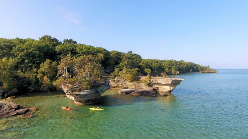
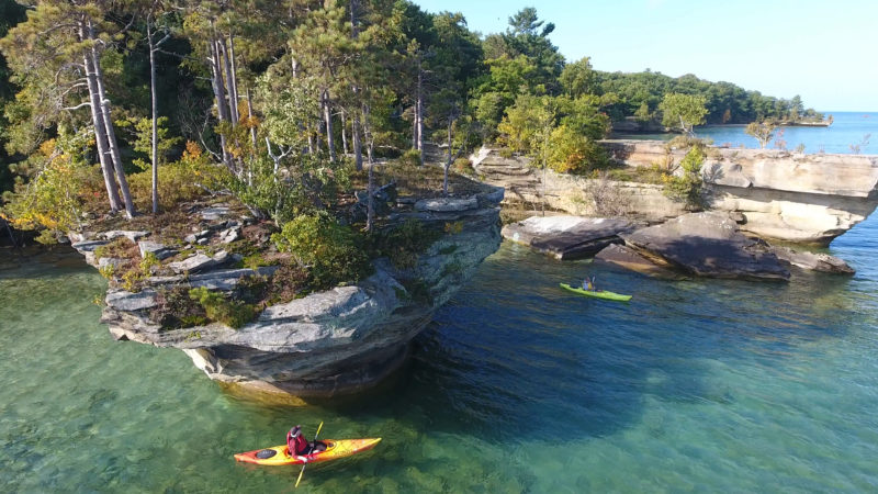
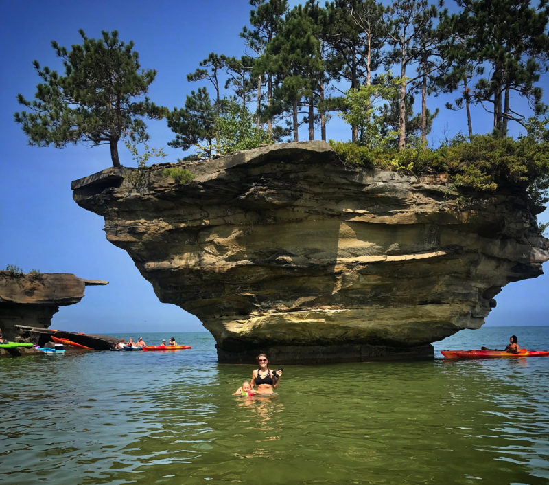
Turnip Rock stunning rock formation in Lake Huron that is a paddler's dream with lower water levels and a sea cave surrounding the rock. This area is not viewable from land because it is private property, view by water only.
CAUTION This is considered an intermediate to advanced paddle, weather conditions can change quickly.
There are 2 drop-in points that will get you to Turnip Rock:
Leaving from Port Austin is the most popular paddle, using Port Austin Kayak rentals and tours for paddle options. If you would rather go by boat excursion, Turnip Rock Tours can take you to see it too. Remember: Take out what you bring in! Leave no trace and keep it in its beautiful, natural state. Be sure to check water conditions and weather before going, file a float plan to tell someone where you are going, and wear a life jacket. Paddle safe!
Photo 1 by | Justin Schnettler
Photo 2 by | Daisy Roux Mitten Adventures
CAUTION This is considered an intermediate to advanced paddle, weather conditions can change quickly.
There are 2 drop-in points that will get you to Turnip Rock:
- Eagle Bay Public Access (Estimated 6.5 miles roundtrip) off Wallace Rd., Port Austin
- Port Austin - Bird Creek Park or the State Harbor (7 miles roundtrip)
Leaving from Port Austin is the most popular paddle, using Port Austin Kayak rentals and tours for paddle options. If you would rather go by boat excursion, Turnip Rock Tours can take you to see it too. Remember: Take out what you bring in! Leave no trace and keep it in its beautiful, natural state. Be sure to check water conditions and weather before going, file a float plan to tell someone where you are going, and wear a life jacket. Paddle safe!
Photo 1 by | Justin Schnettler
Photo 2 by | Daisy Roux Mitten Adventures
Photos
We would like to lookup your present location so we can provide accurate directions.
Your browser may ask for your permission to determine your location (possibly at the top of this page).
If you agree, we will use your current location as the starting point for directions. If you don't agree, you may enter a starting location when the map is displayed.


